


SityTrail - Sommet de Cluchette (Fonbette 04)

Clo0413
User
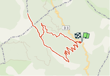

Length
12 km

Max alt
1722 m

Uphill gradient
583 m
Km-Effort
19.7 km

Min alt
1310 m

Downhill gradient
583 m
Boucle
Yes
Creation date :
2025-01-15 11:32:27.723
Updated on :
2025-03-28 08:34:48.285
4h29
Difficulty : Medium

FREE GPS app for hiking
 SityTrail
IGN / Geographical institutes
SityTrail Plus
The world is yours!
About
Trail Walking of 12 km to be discovered at Provence-Alpes-Côte d'Azur, Alpes-de-Haute-Provence, Le Castellard-Mélan. This trail is proposed by Clo0413.
Positioning
Country:
France
Region :
Provence-Alpes-Côte d'Azur
Department/Province :
Alpes-de-Haute-Provence
Municipality :
Le Castellard-Mélan
Location:
Unknown
Start:(Dec)
Start:(UTM)
272135 ; 4899733 (32T) N.
Comments